

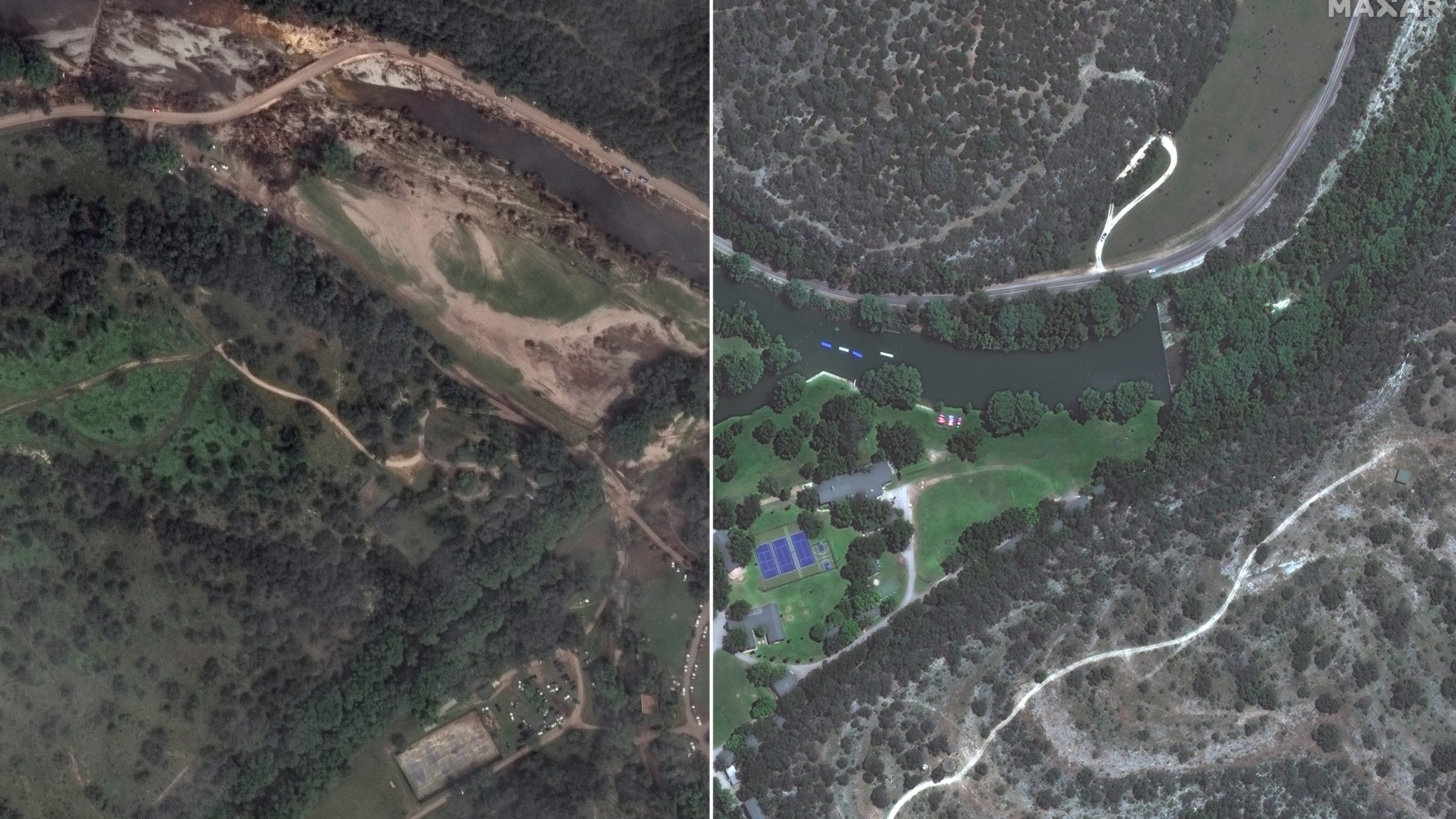
The July 4 Texas flooding has now claimed over 100 lives, with even more still missing as searches continue along the Guadalupe River where forceful floodwaters washed out structures and vegetation. New satellite images reveal the full extent of the devastation in Kerr County, which bore the brunt of the flooding's impacts.
Five days later, the death toll keeps rising steadily as search and rescue teams, as well as volunteers, comb through the debris. The Kerrville Police Department's Jonathan Lamb reports the last "live rescue" was made on Friday, July 4. As time passes, the chances of finding survivors quickly dwindle.
Maxar Technologies, an American space technology company that describes itself as a "leading provider of secure, precise geospatial insights," captured "before" and "after" images of the flood's impact on the area surrounding Camp Mystic.