

A tropical disturbance has formed off of the northeast coast of Florida, and the National Hurricane Center is monitoring the system for potential tropical development as it moves over the Gulf of Mexico over the next couple of days.
As of 10:30 a.m. Wednesday, the system is merely a weak low pressure system, sitting off of the northeast coast of Florida, near Jacksonville. Its circulation is poorly defined, with only a few clouds and thunderstorms loosely spinning around the center.
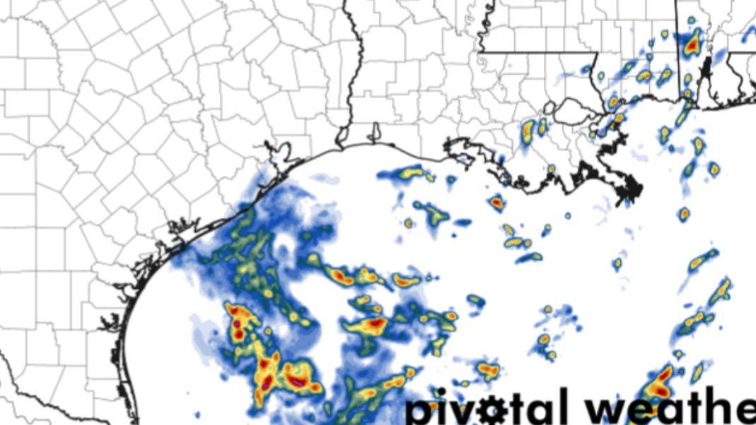
The system is expected to emerge into the eastern Gulf of Mexico by late Wednesday, likely moving westward across the northern Gulf Thursday and Friday. Current projections show the center of circulation nearing the Texas coast by Friday.
Chances for development?
Conditions across the northern Gulf of Mexico are generally favorable for development, thanks to unusually warm sea surface temperatures and low wind shear. Still, the National Hurricane Center is only giving the system only a 10% chance of developing into at least a tropical depression within the next 48 hours. That means the chance of seeing a Tropical Storm Dexter form is even lower.
Why such a low chance? Time is a major factor. A strong high-pressure system over Arkansas and Tennessee is expected to steer the disturbance quickly from east to west, limiting the window for development.
Even if the system begins to organize, it likely won’t have enough time to strengthen into a full-fledged tropical cyclone before reaching the Louisiana or Texas coast. While development is still possible, the odds are stacked against it.
Heavy rain to Texas?
Regardless of whether the disturbance becomes a tropical depression, it’s still likely to bring locally heavy rainfall and a low flooding threat to the Texas Gulf Coast. The highest rain chances will be along the coast, stretching from Corpus Christi and Port Aransas, up toward Galveston and Beaumont.
Rain chances along the coast will likely peak from Friday afternoon through Saturday morning, with chances tapering off as the system pushes farther west. Because the disturbance is disorganized, any rainfall will likely come in scattered bursts rather than lasting all day.
Most coastal areas are expected to receive less than an inch of rain, though isolated spots could see up to 3 inches. Exactly where the heaviest rain falls will depend on the track of the system’s center of circulation.
Farther inland, cities like Laredo, San Antonio, and Austin will see their best chances of rain on Saturday. However, rainfall is expected to be scattered, unless the system strengthens more than currently forecast. As of now, San Antonio has about a 20 to 30% chance of rain — but stay tuned to expressnews.com/weather for the latest updates.
2025 hurricane season
We’ve seen a relatively slow start to the 2025 Atlantic hurricane season. So far, three named storms – Andrea, Barry, and Chantal – have formed, but none have reached hurricane strength.
While it may seem quiet, this isn’t unusual. June and July are typically two of the calmer months of hurricane season. Activity usually ramps up in late summer as ocean temperatures rise and Saharan dust over the central Atlantic begins to clear.
Climatologically, August and September are the peak months for hurricane formation. Earlier this year, the National Oceanic and Atmospheric Administration predicted an above-average hurricane season, with 6 to 10 hurricanes expected to form across the Atlantic basin.