

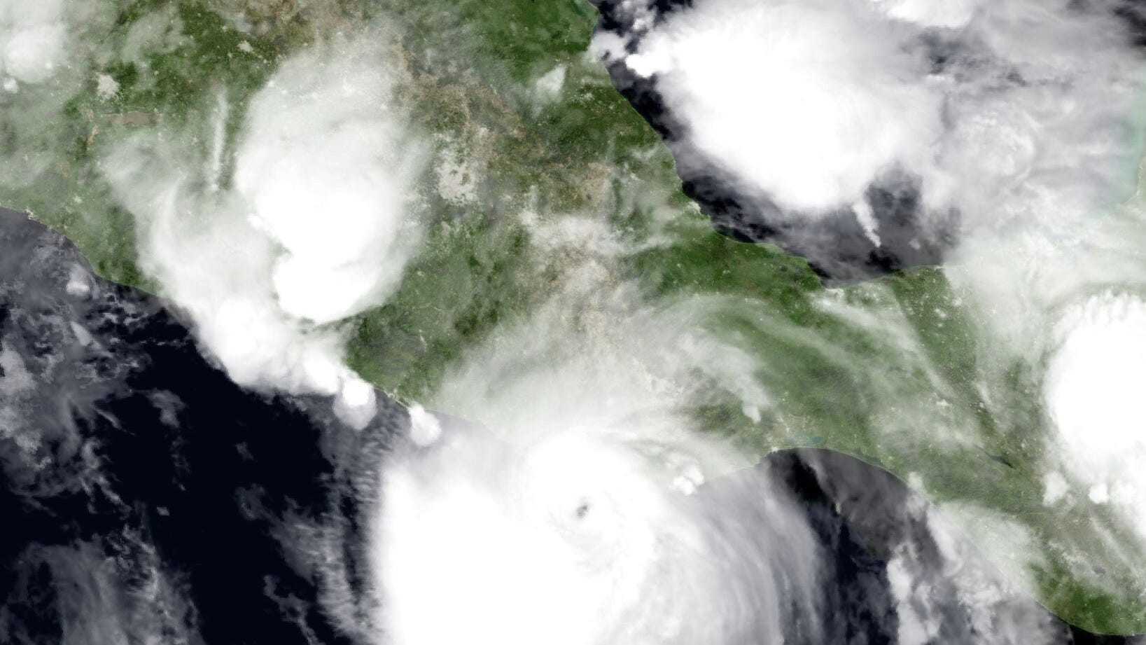
We are officially two months into hurricane season and while the Atlantic Basin has remained relatively quiet, the Pacific Basin has been highly active. So far, it has seen nine named storms, including five tropical storms and four hurricanes — three of which were major hurricanes with wind speeds exceeding 111 mph.
Among these was the historic Hurricane Erick in early June, which rapidly intensified from a tropical storm to a Category 4 hurricane in less than 24 hours, with winds reaching 145 mph. Notably, this was the earliest major hurricane to make landfall on either coast of Mexico.
In contrast, the Atlantic has only produced three named storms so far, Andrea, Barry and Chantal. However, despite the seemingly slow start to the season, the number of named storms we’ve had so far is slightly ahead of schedule. According to the National Hurricane Center, historical data from 1991 to 2020 show that we typically see our third named storm by as late as Aug. 3. On average, the first hurricane forms by Aug. 11, and the first major hurricane in the Atlantic Basin occurs by Sept. 1.
This month should be focused on preparation and planning for when, not if, the next tropical system develops. Tropical cyclone development historically begins to ramp up significantly in August, with hurricane activity peaking in mid-September. The National Hurricane Center continues to forecast an above-normal season this year, predicting 13 to 19 named storms by the end of November. Of those named storms, six to 10 would be hurricanes with winds of 74 mph or higher, and three to five would be major hurricanes with winds exceeding 111 mph.
In Texas, we typically focus on tropical cyclones forming in the Atlantic Ocean, the Caribbean Sea and the Gulf of Mexico, where storms that directly affect Texas most often originate. During August, the focus will be on tropical waves of low atmospheric pressure moving off Africa and across the tropical zone, which is the warm region of the world between the Tropic of Cancer (about 23 degrees north latitude) and the Tropic of Capricorn (about 23 degrees south latitude), with the equator right in the middle.
Tropical cyclones can also form from surface troughs of low pressure, like the rain-making ones that moved into Texas over the past three weekends. Both troughs and tropical waves are elongated areas of low pressure that can spark cyclone development. Dying frontal boundaries off the coast also can create areas of low pressure and instability in the atmosphere, which can lead to cyclone formation.
The National Hurricane Center’s seven-day outlook predicts a quiet start to August, but the European Centre for Medium-Range Weather Forecasts highlights the potential for a tropical cyclone to form along the U.S. East Coast. The forecast model suggests that the coasts of Georgia, South Carolina, and North Carolina have a 50-70% chance of a tropical cyclone developing by Aug. 10.
It’s impossible to say for sure whether Texas will face a hurricane landfall this year, but the chances of landfall have grown in recent decades, according to Colorado State University researchers, the authors of a well-regarded annual hurricane season forecast. They estimate that a hurricane has a 41% chance of hitting the Texas Gulf Coast this year, which is about 5 percentage points above the 1880-2020 average derived from historical records.
With the most active part of hurricane season ahead, now is a great time to remind everyone that you also should be checking in with the Statesman's weather forecasts a few times a week, especially given how the Texas Gulf Coast is so vulnerable to rapidly developing tropical systems.